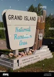
Including the cities of Grand Marais, Munising, Newberry, Escanaba, Gladstone, Manistique, and Seney
…WINTER WEATHER ADVISORY NOW IN EFFECT FROM NOON TODAY TO 10 PM EST THIS EVENING…
* WHAT…Freezing rain expected, possibly mixed with light snow. Ice accumulations of up to one tenth of an inch. Winds gusting as high as 40 mph.
* WHERE…Alger, Luce, Delta, Southern Schoolcraft and Northern Schoolcraft Counties.
* WHEN…From noon today to 10 PM EST this evening.
* IMPACTS…Plan on slippery road conditions and hazardous travel, especially during the evening commute. Lesser traveled roads are more likely to be impacted.
* ADDITIONAL DETAILS…Temperatures are expected to warm above freezing by late afternoon or early evening. However ice may continue to accumulate on roads and sidewalks even after temperatures warm above freezing.
Including the cities of Copper Harbor, Ontonagon, Houghton, Hancock, L`Anse, Gwinn, Marquette, Kenton, and Sidnaw
…WINTER WEATHER ADVISORY NOW IN EFFECT FROM NOON TODAY TO 10 PM EST THIS EVENING…
* WHAT…A mix of snow and freezing rain expected. Total snow accumulations of up to one inch, mainly over the Keweenaw
Peninsula and other higher elevation areas. Ice accumulations of around one tenth of an inch, except less over the Keweenaw
Peninsula and near Lake Superior. Winds gusting as high as 35 mph.
* WHERE…Portions of central Upper and western Upper Michigan.
* WHEN…From noon today to 10 PM EST this evening.
* IMPACTS…Plan on slippery road conditions and hazardous travel, especially during the evening commute. Lesser traveled roads are more likely to be impacted.
* ADDITIONAL DETAILS…Temperatures are expected to warm above freezing around L`Anse and Baraga, and in the lower elevations
of eastern Marquette County. However ice may continue to accumulate on roads and sidewalks even after temperatures warm above freezing.
Including the cities of Ironwood, Iron River, Iron Mountain, and Menominee
…WINTER WEATHER ADVISORY NOW IN EFFECT FROM 9 AM THIS MORNING TO 9 PM CST THIS EVENING…
* WHAT…A mix of snow and freezing rain expected. Total snow accumulations of up to one inch. Ice accumulations of around one tenth of an inch, except less near Lake Superior and Lake Michigan. Winds gusting as high as 35 mph.
* WHERE…Menominee, Gogebic, Dickinson and Iron Counties.
* WHEN…From 9 AM this morning to 9 PM CST this evening.
* IMPACTS…Plan on slippery road conditions and hazardous travel, especially during the evening commute. Lesser traveled roads are
more likely to be impacted.
* ADDITIONAL DETAILS…Temperatures are expected to warm above freezing east of Crystal Falls this afternoon. However ice may
continue to accumulate on roads and sidewalks even after temperatures warm above freezing.