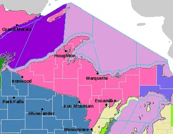
Including the cities of Hancock, L`Anse, Gwinn, Marquette, Grand Marais, Munising, Ironwood, Iron River, Iron Mountain, Kenton, and Sidnaw …
WINTER STORM WARNING IN EFFECT FROM 7 AM EST /6 AM CST/ MONDAY TO 1 AM EST /MIDNIGHT CST/ TUESDAY… *
WHAT…Heavy snow expected. Total snow accumulations of 7 to 10 with over a foot in the higher elevations. * WHERE…Portions of central Upper and western Upper Michigan. *
WHEN…From 7 AM EST /6 AM CST/ Monday to 1 AM EST /midnight CST/ Tuesday. *
IMPACTS…Travel will be very difficult for the morning and evening commute. Isolated power outages are possible. Very heavy wet snow with rates of 2 to 3 inches per hour are expected Monday morning. Area roadways and visibility will deteriorate quickly during the morning commutemaking travel very difficult. If you must travel, keep an extra flashlight, food, and water in your vehicle in case of an emergency.
Including the cities of Menominee, Escanaba, Gladstone, Manistique, and Seney
* WHAT…Heavy snow expected. Total snow accumulations of 6 to 9 inches. Snow amounts could be lower along the immediate lakeshores. *
WHERE…Menominee, Delta, Southern Schoolcraft and Northern Schoolcraft Counties. *
WHEN…From 7 AM EST /6 AM CST/ Monday to 1 AM EST /midnight CST/ Tuesday. *
IMPACTS…Travel will be very difficult for the morning and evening commute. Isolated power outages are possible due to heavy snow accumulations on trees and power lines. *
ADDITIONAL DETAILS…Very heavy wet snow with rates of 1 to 3 inches per hour are expected Monday morning. Road conditions and visibility will deteriorate quickly during the morning commute, making travel very difficult. This snow will be very heavy and difficult to clear. Remember to take frequent breaks when shoveling.
Including the city of Newberry ..
.WINTER STORM WARNING IN EFFECT FROM 7 AM MONDAY TO 1 AM EST TUESDAY…
* WHAT…Heavy mixed precipitation expected. Total snow accumulations of 5 to 7 inches and ice accumulations of 0.1 inches or more possible. *
WHERE…Luce County. *
WHEN…From 7 AM Monday to 1 AM EST Tuesday. *
IMPACTS…Travel will be very difficult for the morning and evening commute. Isolated power outages are possible. *
ADDITIONAL DETAILS…Very heavy wet snow with rates of 2 to 3 inches per hour are expected Monday morning. Area roadways and visibility will deteriorate quickly during the morning commute making travel very difficult.


")


