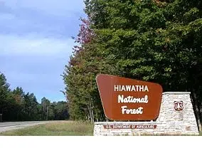
The US Forest Service plans to burn vegetation piles in ten different areas of the Hiawatha National Forest this fall and winter. Current weather forecasts suggest suitable burning weather may occur in the next several weeks. If conditions are not right, the burns will be postponed until more favorable conditions this winter. A map of these potential prescribed burns is available online.
West Zone Locations:
- The Gravel Pit Burn is approximately 6 miles south east of Chatham located in T45N, R18W, Section 10. The piles cover approximately 5 acres. During active pile burning, smoke may be visible from the Rapid River Truck Trail (FR 2234) in Alger County. These piles when lit in the morning will take the whole day to consume.
- The Pine Marten Run project is approximately 1 mile west of Triangle Lake Campground located off County Road 440 in T44N, R18W, Section 35. The piles cover approximately 45 acres. In the Pine Martin area, smoke may be visible from Triangle Lake and County Road 440 in Schoolcraft County. These piles when lit in the morning will take the whole day to consume.
- The Jack Pine project near the Indian River Campground located off M-94 in T43N, R17W, Section 2. The piles cover approximately 30 acres. In the area of the Jack Pine Project smoke may be visible from Indian River Campground and Jack Pine Lodge in Schoolcraft County. These piles when lit in the morning will take the whole day to consume.
- The Runway project is approximately 3 miles north of Camp 7 Lake Campground located off County Road 442 in T43N, R18W, Section 27. The piles cover approximately 15 acres. In the Runway area, smoke may be visible from Gooseneck Lake and County Road 442 in Delta County. These piles when lit in the morning will take the whole day to consume.
- The Clear Lake project is approximately 7 miles south of Shingleton located off M-94 in T 45 N, R 17 W, Section 34. The piles cover approximately 5 acres. In the Clear Lake area, smoke may be visible from Clear Lake and M-94 in Schoolcraft County. These piles when lit in the morning will take the whole day to consume.
- The Crooked Lake project is approximately 9 miles south of Shingleton located off M-94 in T 44 N, R 17 W, Section 10 & 15. The piles cover approximately 6 acres. In the Crooked Lake area, smoke may be visible from Crooked Lake and M-94 in Schoolcraft County. These piles when lit in the morning will take the whole day to consume.
- The McKeever project is approximately 14 miles south of Munising located of FH-13 in T 44 N, R 18 W, Section 7. The piles cover approximately 5 acres. In the McKeever area, smoke may be visible from McKeever Lake and FH-13 in Schoolcraft County. These piles when lit in the morning will take the whole day to consume.
- The Stonington project is approximately 6 miles south of Rapid River and just east of County road 513 on the Stonington Peninsula in T40N, R21W, S 30. The piles cover approximately 1 acre. During active pile burning in the South Schaawe area, smoke may be visible from Gladstone, US Highway 2 east of Rapid River, and along county road 513 in Delta County. These piles when lit in the morning will take the whole day to consume.
East Zone Locations:
- Burma Grade piles approximately 4 miles north of Brevoort Lake Campgound. Located in T42N, R5W, Section 6. There are less than 20 piles that should take one day to ignite and an additional day to mop-up. Smoke will not impact paved roads nor nearby towns.
- Boedne Camp piles are located just north of Boedne Bay. Located in T42N, R5W, Section 19. There are less than a dozen piles that should take less than one day to ignite and an additional day to mop-up. Smoke will not impact nearby paved roads nor nearby towns.
During active burning, smoke and flames may be visible from roads and in areas downwind of the burn site. Smoke may settle in some areas in the evening hours, however, ignition days and times will be adjusted to avoid smoke sensitive areas. If you have health problems that may be aggravated by smoke, please contact the appropriate Zone Fire Management Officer: West Zone, Cory Henry (906) 474-6442; or East Zone, Brenda Dale (906) 298-8150. Affected individuals can request to be notified of prescribed fires that are conducted on Forest Service lands in their vicinity the day of the burn.
Prescribed burning provides benefits to our natural resources as well as reducing hazardous fuels on our National Forest. The Forest Service’s goals in burning the wildlife openings are:
- Reduce the risk of wildfires by reduce hazardous fuels.
- Provide improved breeding and foraging habitat for early-successional and cavity dependent species.
- Set back vegetative succession and maintain wildlife openings.
- Maintain burn units as part of a system of fuel breaks (including safety zones, escape routes, staging areas and control lines).
- Remove or reduce the impact of non-native invasive species
- Train personnel in the use of wildland fire in a safe and efficient manner.
The Forest Service’s primary goal in conducting pile burns is to reduce hazardous fuel loading within unit.
Please contact your local Forest Service office if you have any questions.










Comments